Papers (Hazard, vulnerability and Risk) by Lúcio Cunha
Iberografias - 50 - NARRATIVAS AMBIENTAIS, COMUNIDADDES TRADICIONAIS E DESENVOLVIMENTO RURAL, 2026
Este artigo propõe uma reflexão aprofundada sobre as comunidades do baixo Madeira durante a histó... more Este artigo propõe uma reflexão aprofundada sobre as comunidades do baixo Madeira durante a histórica enchente de 2014. Esse evento catastrófico desencadeou um processo de desterritorialização5, forçando os ribeirinhos a um rearranjo drástico de seu cotidiano, com a transferência temporária das famílias para alojamentos improvisados em Porto Velho. A vida dessas comunidades é intrinsecamente ligada ao ritmo das águas do Rio Madeira, que oscila entre a vazante e a cheia, marcando o tempo das chuvas, conhecido como o inverno amazônico. Para este estudo, o baixo e médio Madeira compreendem as comunidades situadas no baixo e médio Madeira, a jusante de Porto Velho.
Iberografias, 2026
Neste trabalho discutem-se os efeitos dos eventos climáticos de cheia e seca, ocorridos no Estado... more Neste trabalho discutem-se os efeitos dos eventos climáticos de cheia e seca, ocorridos no Estado de Rondônia desde o ano de 1967, até aos dias atuais. Através da série histórica de dados da cota do rio, é possível traçar uma linha progressiva da amplificação dos eventos extremos que atingiram o Estado ao longo de 6 décadas. O Rio Madeira foi usado como balizamento para o estudo por ser a “calha” das águas do Estado, recepcionando os principais rios que drenam Rondônia. Os dados analisados apontam para eventos cada vez mais constantes, mais alongados e mais intensos, situação que provoca preocupação tanto na população quanto no poder público, e que reflete diretamente na economia regional. Ao refletir sobre os dados, é possível fazer uma correlação com a evolução da ocupação e do uso da terra em Rondônia, processos estreitamente ligados ao avanço do desmatamento acelerado, conversão da floresta em áreas de pastagem e monocultura da soja, perda da biodiversidade, soterramento de nascentes, compactação do solo, baixa infiltração de águas pluviais comprometendo a recarga dos mananciais, ao que potencializa os processos erosivos com assoreamento dos cursos d’água, perda e esterilização do solo e descaracterização do Bioma Amazônia, com o avanço do Bioma Cerrado no sentido norte no Estado. É fundamental compreender as causas das alterações climáticas globais e macro-regionais que afetam o clima de Rondônia, e refletir sobre o modelo desenvolvimentista predominante atualmente e a insustentabilidade socioeconômica e ambiental a médio e longo prazo.
PALAVRAS-CHAVE: mudanças climáticas; crise hídrica; Rio Madeira; Rondônia.
Cadernos de Geografia, 2025
Desertification generally has adverse environmental, social, and economic consequences. However, ... more Desertification generally has adverse environmental, social, and economic consequences. However, areas lacking adequate social and infrastructural conditions face greater challenges in addressing the risks associated with desertification. Research evaluating the socio-environmental implications of the desertification process remains limited. In Brazil, the Cabrobó desertification nucleus is characterised by significant economic activities such as irrigated fruit farming and fish farming. Although this region has been the subject of several studies addressing the physical and natural impacts of desertification, investigations focusing on socio-environmental aspects, particularly vulnerability, are still scarce. Vulnerability mapping is a crucial tool for informing and improving public policy, particularly when it is based on census sector data. This study aimed to develop vulnerability maps of the desertification risk for the Cabrobó desertification nucleus. The analysis utilised census sector data from five municipalities: Cabrobó, Belém do São Francisco, Carnaubeira da Penha, Itacuruba, and Floresta, based on the 2010 census, the last provided by the Brazilian Institute
of Geography and Statistics (IBGE). It was not possible to use more recent census sector data, as such data are currently unavailable. Social variables and environmental variables were included in the analysis. Indices were generated using Exploratory Factor Analysis and
subsequently visualised on maps. The results revealed varying levels of vulnerability across census sectors, with social and rural socio-environmental vulnerabilities being particularly high. Strengthened collaboration between government and society is essential for improving
regional conditions. The findings of this study may support the development of targeted social assistance policies for residents of the region.
Keywords: Socio-environmental vulnerability. Cabrobó desertification nucleus. Census sectors. Exploratory factor analysis. Public policies.
Territorium, 2024
ABSTRACT
The major anthropic changes to the landscape in recent decades, which reflect human ways... more ABSTRACT
The major anthropic changes to the landscape in recent decades, which reflect human ways of life in the area, have led to an increase in social and environmental vulnerability studies, particularly when we realize that these ways of life help people to deal with natural hazards. In different fields of science, vulnerability has been approached by analysing the various variables that influence this phenomenon. In the present work, with the aim of analysing the social and environmental vulnerability of the municipality of Rio Claro/RJ to hydrogeomorphological risks, an exploratory factor analysis was carried out using data from the IBGE demographic census of 2010 and a map of social and environmental vulnerability was drawn up. The maps indicate that most of the smaller sectors, which are located in urban areas, have lower vulnerability rates, while the larger sectors, which are mostly rural, have medium and high vulnerability. This is due to the lack of infrastructure and resources in rural areas, which end up making people more vulnerable to hydrogeomorphological risks.
Keywords: Vulnerability, social, environmental, exploratory factor analysis.

Iberografias , 2024
www.ancora-editora.pt www.facebook.com/ancoraeditora O Centro de Estudos Ibéricos respeita os ori... more www.ancora-editora.pt www.facebook.com/ancoraeditora O Centro de Estudos Ibéricos respeita os originais dos textos, não se responsabilizando pelos conteúdos, forma e opiniões neles expressas. A opção ou não pelas regras do novo acordo ortográco é da responsabilidade dos autores. Apoio: O Curso de Verão, a leitura do território e o diálogo trans-ibérico Rui Jacinto I. PAISAGEM E GESTÃO DOS RECURSOS NATURAIS Dinâmica da paisagem e mudanças do uso e cobertura da terra na raia divisória São Paulo-Paraná-Mato Grosso do Sul, Brasil: uma análise a partir dos dados do projeto MapBiomas Diogo Laércio Gonçalves, Messias Modesto dos Passos Mudanças no uso e cobertura da terra no projeto de assentamento corta corda, Santarém, Pará, Brasil: uma análise através de imagens do Projeto MapBiomas Gabriel Fiorin Pereira e Diogo Laércio Gonçalves Análise do uso e cobertura da terra na bacia hidrográca do Rio São Francisco a partir de dados da plataforma Mapbiomas (1988; 2008; 2021
XXV SIMPÓSIO BRASILEIRO DE RECURSOS HIDRÍCOS, 2023
The concentration of a significant segment of the world's population and the development of numer... more The concentration of a significant segment of the world's population and the development of numerous socioeconomic activities currently apply strong pressure on coastal zones. Records of adverse natural events, often related to climate change, have indicated scenarios of natural risks associated with coastal erosion and other coastal processes that require an integrated management, thus considering and evaluating risk processes in their two main components: hazard and vulnerability. Therefore, the selected spatial scope for this study comprises the Metropolitan Region of Baixada Santista, São Paulo (Brazil), and the Coastal Zone of Aveiro District (Portugal), as these areas face several potentially hazardous processes in their coastal zone, both historical and current. These areas present conflicting relationship of disorderly land use and intensification of natural risk processes, extended by irregular settlement patterns amplified by real estate pressure. The presented results and discussions enable an integrated view of the territory for adopting mitigating actions by the government for local, regional, and national management, as well as contribute to the international discussion. Finally, understanding the role of natural risks and socio-environmental vulnerability in coastal zones at a multiscale level is a fundamental resource for both science and the government to adopt and establish prevention, alert, mitigation, and recovery policies and actions for these areas.
América Latina ante los (nuevos) retos de la justicia social y ambiental, 2023
do Território, onde coordena o Grupo 1-Natureza e dinâmicas ambientais. Colaborador estrangeiro d... more do Território, onde coordena o Grupo 1-Natureza e dinâmicas ambientais. Colaborador estrangeiro do Grupo de Pesquisa em Geotecnologias e Cartografia aplicadas à Geografia (CNPq/Brasil).
O objetivo deste trabalho foi realizar um estudo da dinâmica da paisagem, na planície deltaica do... more O objetivo deste trabalho foi realizar um estudo da dinâmica da paisagem, na planície deltaica do Rio Doce, com base no registro de maior precipitação e de vazão mensal dos últimos 62 anos. Com os produtos e técnicas de Sensoriamento Remoto, como as imagens da série Landsat, em períodos distintos (vazante e cheia do rio), permitiu avaliar os conflitos de usos e a dinâmica natural do ambiente. Os resultados envidenciaram não apenas a extensa área inundável e o impacto das inundações em áreas residenciais, mas também os ambientes conservados e a dinâmica das paisagens em questão, constatando interação negativa entre a magnitude dos processos urbanísticos empreendidos na região e as grandes inundações.
XVIII Simpósio Brasileiro de Geografia Física Aplicada, 2019
O presente estudo tem como objetivo principal fornecer um diagnóstico das mudanças na morfologia ... more O presente estudo tem como objetivo principal fornecer um diagnóstico das mudanças na morfologia fluvial do médio/baixo rio Doce entre os anos de 1977 e 2017, apresentando uma visão das áreas de erosão marginal e da intensidade destes processos na calha do canal principal, analisada através da Estimativa de Densidade de Kernel (EDK). Para isso, o trecho desse rio a jusante da usina hidrelétrica de Aimorés foi analisado com base em imagens temporais da série Landsat e campanhas de campo. Essa análise revelou uma erosão de 241,9 hectares da calha no trecho de 141,6 km, com uma taxa média de erosão de 1,51 hectares/ano durante o período analisado. Este trabalho contribui para o melhor entendimento da dinâmica dos sistemas fluviais de médio e grande porte e para promover ações de controle e monitoramentodos processos de erosão marginal, especialmente, daqueles desprovidos de análises / levantamentos dessa natureza. Palavras chave: Geomorfologia fluvial; Taxas de erosão; Diagnóstico de bacias hidrográficas; Sensoriamento Remoto; Geotecnologias.
GeoAmazônia, 2022
The determination of resilience capacity constitutes an important tool for environmental conserva... more The determination of resilience capacity constitutes an important tool for environmental conservation and preservation. The aim of the present study was to evaluate the environmental resilience capacity of the lower course of the basin of the Poti River (LCPR) in the state of Piauí in northeastern Brazil. For such, analyses were performed of the natural and socioeconomic aspects of the area. A geographic information system was used for interpreting the lower Poti River and identifying the main existing environmental risks. The images were edited using SPRING 5.2 and ARCMAP 10.3. Environmental resilience capacity was determined by calculating an environmental resilience index (ERI) based on two additional indexes: the natural resilience index (NRI) and the municipal social vulnerability index (MSVI). Environmental resilience capacity was low in the urban areas of the river due to the greater pressure on the environment as a result of demographic density and the exploitation of natural resources. In contrast, rural areas (86 percent of LCRP) showed a moderate-to-high degree of environmental resilience, due to the occurrence of large areas predominantly covered with natural vegetation. The municipal social vulnerability index reflects the various public strategies adopted by administrators. Another finding was that the method developed for evaluating environmental resilience based on the analysis of natural resilience and social vulnerability is important to the planning and management of river basins in terms of the sustainable development of its uses in different geographic areas.
Revista GeoAmazônia
The determination of resilience capacity constitutes an important tool for environmental conserva... more The determination of resilience capacity constitutes an important tool for environmental conservation and preservation. The aim of the present study was to evaluate the environmental resilience capacity of the lower course of the basin of the Poti River (LCPR) in the state of Piauí in northeastern Brazil. For such, analyses were performed of the natural and socioeconomic aspects of the area. A geographic information system was used for interpreting the lower Poti River and identifying the main existing environmental risks. The images were edited using SPRING 5.2 and ARCMAP 10.3. Environmental resilience capacity was determined by calculating an environmental resilience index (ERI) based on two additional indexes: the natural resilience index (NRI) and the municipal social vulnerability index (MSVI). Environmental resilience capacity was low in the urban areas of the river due to the greater pressure on the environment as a result of demographic density and the exploitation of natura...
WSD 22, 2022
The historical records of floods and their impacts in the Mondego river basin (Portugal) – partic... more The historical records of floods and their impacts in the Mondego river basin (Portugal) – particularly in the city of Coimbra and its downstream floodplain – show the complexity of physical and human interactions in the construction of flood risk. In this short paper, a summarized notice on the past flood events is done, highlighting the persistence of damages both in pristine and regularized conditions, and pointing to the role of an intermediate area, which is a source of uncertainty in flood peak estimation to the city of Coimbra and the Lower Mondego terrains. This analysis is possible due to the construction of an extensive and detailed database of historical records of hydrometric levels, rainfall data, damage descriptions and a survey of the public and private loss mitigation and rehabilitation measures.
MÉTODOS E TÉCNICAS NO ESTUDO DA DINÂMICA DA PAISAGEM FÍSICA NOS PAÍSES DA CPLP - COMUNIDADE DOS PAÍSES DE EXPRESSÃO PORTUGUESA, EUMED. Málaga, 2022
Risco de Cheias e Risco de Inundações Fluviais. Aprender com o Passado". , 2022
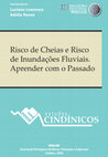
Historical documentary sources and hydrometric records were used to
study 296 floods that occurre... more Historical documentary sources and hydrometric records were used to
study 296 floods that occurred in the period from 1200 to 2021. Of these floods, 32 were classified as catastrophic and 60 as extraordinary, occurring particularly in winter (December to February). These floods had very significant negative impacts on social, economic and environmental systems, including loss of human life. They cut off populations and caused illness, agricultural and livestock losses, and destroyed hydraulic infrastructure and communication routes, houses, churches, convents, and commercial establishments. Historical records even report various periods of famine in Coimbra and in the riverside localities. Although most of the floods with exceptionally high impacts occurred in the pristine fluvial regime, due to the greater interval of time covered, the historical and hydrometric records show that exceptional and very damaging floods continue to occur in the post-project period of hydroelectric and hydro-agricultural exploitation, as borne out by the floods of 2001 and 2019. Assuming that events of this nature can occur in the future, there is a need to adapt the current management system of the Mondego River Hydrographic Basin to this reality to mitigate possible damage and losses.
Keywords: River Mondego, floods, impacts
Espaço em revista, 2022
The social and economic changes caused in urban and rural environments have acquired the greatest... more The social and economic changes caused in urban and rural environments have acquired the greatest repercussions due to the accelerated changes in landscapes. In this sense, the relief stands out for being the surface that makes life possible, allowing the interaction between the dynamics of nature and society. In it, the morphodynamic and morphogenetic processes occur, responsible for the formation of the relief. Currently, the dynamics of society are visible, interpenetrate and/or stand out from the dynamics of nature. Such environmental issues assume importance in several fields of knowledge, especially in geographic science. In this respect, the work has as main objective to understand the morphodynamics of the relief; related to the characteristics that determine and influence the environmental vulnerability index to linear erosive processes in the municipality of Mirante do Paranapanema - SP, we emphasize here that environmental vulnerability refers to linear erosive processes, so, furrows, ravines, and gullies. For the elaboration of cartographic documents, it was necessary to use geotechnologies, Geographic Information Systems - SIG, satellite images, and software such as Arc Gis 10.6.1, Quantum Gis 2.16, IBGE geographic data information (shapes), satellite images: ALOS / PRISM; SRTM; Sentinel; and Landsat 8, for the Water Balance the Excel software, and the use of the Hierarchical Analytical Process Technique - AHP for the elaboration of the final maps of Environmental Vulnerability to the Linear Erosive Process. The interrelationships of natural elements: geomorphology, terrain curvature, slope, simplified soil sketch, surface temperature, and vegetation index (NDVI); as well as the social aspects: land occupation and its use, crossed among themselves, and through certain weights defined based on bibliographic references and fieldwork, from the technical perspective of the geographers involved in the present dissertation, made it possible to elaborate maps of environmental vulnerability to linear erosive processes, from March to June 2016, concerns periods of higher humidity (rainy) and dry (drought) on the surface of the studied area. Such results helped, as tools for the spatialization of geomorphological phenomena, in the deepening of studies on the theme of erosion in the region of Pontal do Paranapanema - SP. Finally, it was observed that the different levels of environmental vulnerability to linear erosive processes, in climatic conditions: dry and/or humid, are directly related to land uses, interconnected to the types of relief, soils, vegetation cover, and dynamics of historical occupation by social groups/individuals. In this regard, it was possible to notice that there is a difference in intensity in the environmental vulnerability to linear erosive processes in two periods of the year. Keywords: Environmental Vulnerability. Analytical Hierarchy Process (AHP). Linear Erosion. Geomorphological Mapping. Mirante do Paranapanema – SP
Sustainability, 2022
Abstract: Mainland Portugal is a Mediterranean country, particularly known for the recurrence of ... more Abstract: Mainland Portugal is a Mediterranean country, particularly known for the recurrence of forest fires in terms of burnt areas, losses, and damage. The central Portugal administrative area has been in a “stage” of prominence for this dangerous phenomenon, with the sub-region Pinhal Interior Sul being one of the most critical territories. In addition to the manifestation of the dangerous process itself, it is important to state the importance of vulnerability, which has been relatively ignored in the definition of public policies in terms of spatial planning. Vulnerability concerns the way people and their assets are exposed to forest fires (as they represent the main targets of their
harmful consequences), as well as how they are affected by, resist, and recover from them. This paper investigates only one of the components of vulnerability—social vulnerability—in terms of demographic, cultural, socio-economic, and infrastructural conditions to establish a comparative
analysis among the parishes of the sub-region Pinhal Interior Sul (in particular, between the more urban and rural ones in each municipality). In the studied area, the high values of social vulnerability reinforce the high hazard level. At the municipality level, it is possible to conclude that the population living in more markedly rural and peripheral parishes is more vulnerable to forest fires than those living in the more urban conditions.
Keywords: forest fires; social vulnerability; factorial analysis; rural and urban parishes; public policies .
Entre Lugar, 2021
Objetivou-se compreender a relação entre o ambiente físico e antrópico, para analisar o nível de ... more Objetivou-se compreender a relação entre o ambiente físico e antrópico, para analisar o nível de vulnerabilidade social e as alterações sobre os aspectos físicos no baixo curso do rio Poti (Piauí-Brasil). Foi elaborado o Índice Municipal de Vulnerabilidade Social (IMVS), com base na análise fatorial por componentes principais por setor censitário, utilizando os softwares SPSS e ArcMap 10.2. Constatou-se que a área rural apresenta IMVS de alto a muito alto devido à baixa densidade demográfica, reduzida infraestrutura, baixa renda, o reduzido nível de escolaridade e o maior envelhecimento da população, tendo em vista que sua maior parte economicamente ativa encontra-se nas áreas urbanas. Quanto aos aspectos naturais, verificou-se que a vegetação tem forte influência na conservação do ambiente, que a sua retirada, de forma inadequada provoca impactos negativos ao meio ambiente e, consequentemente, sobre a população. Assim, o conhecimento sobre vulnerabilidade social em uma bacia hidrográfica permite aos governantes integrar políticas e medidas preventivas no planejamento e estratégias de desenvolvimento sustentável em meio urbano e rural.
Revista Caminhos da Geografia, 2021
THE INGESTION OF FLUORIDE IN SURFACE WATERS AND TERRITORIES WITH RISK TO HUMAN HEALTH IN THE NORT... more THE INGESTION OF FLUORIDE IN SURFACE WATERS AND TERRITORIES WITH RISK TO HUMAN HEALTH IN THE NORTHEAST PARANÁ REGION In the Northeast of Paraná, fluoride levels in surface waters for public supply are above those recommended for human health (≥ 0.8 mg/L). Within Brazilian law, the daily intake of fluoride levels outside the range of 0.6 to 0.8 mg/L can facilitate the generation of pathologies such as caries and fluorosis. Thus, the current investigation aimed to identify locations where the natural fluoride concentrations obtained in drainage basins delimit areas of risk to human health through direct ingestion. For this purpose, two hundred georeferenced raw water samples were collected (2016-2018) from hydrographic basins that supply the region, all of which were chemically analyzed for fluoride using the Direct Potentiometry technique (≤ 1.2 mg/L). The spatialization of the data indicates municipalities potentially prone to the risk of dental fluorosis, with peak levels aligned in the SW-NE direction, representing a belt of anomalies (Jundiai do Sul, Santo Antônio da Platina, and Jacarezinho). The results also specify municipalities at risk for caries. The findings indicate that new epidemiological and hydrogeochemical surveys should be carried out, especially in groundwater, to better delimit the scope of the risks and support the planning of Public Health. Keywords: Fluorine. Risks. Hydrogeochemistry. Northeast Paraná. Public health.
Perspectivas geográficas., 2021
Geosul, 2020
Resumo: A adoção de políticas para a redução de risco de desastres encontra entraves que limitam ... more Resumo: A adoção de políticas para a redução de risco de desastres encontra entraves que limitam suas aplicações. A análise de episódios emblemáticos e dos marcos referenciais e normativos dessas políticas no Brasil serviu como ponto de partida para um diagnóstico dessa condição. O objetivo dessa pesquisa foi mostrar, por meio de pesquisa documental e bibliográfica, como a adoção de políticas para a redução de risco de desastres encontra obstáculos que dificultam e limitam a sua aplicação. O presente estudo revelou três fatores: 1) governança baseada em assimetrias de poder, 2) insuficiência de integração entre políticas públicas nas diferentes escalas de gestão e 3) baixa articulação entre as políticas estatais e os conhecimentos acadêmicos. Palavras-chave: Governança. Resiliência. Políticas Públicas. Gestão pública. Extensão Acadêmica. CHALLENGES AND STRATEGIC POSSIBILITIES FOR A DISASTER RISK REDUCTION POLICY Abstract: The adoption of policies for disaster risk reduction has obstacles that limit its applications. The analysis of emblematic episodes and the referential and normative frameworks of these policies in Brazil served as a starting point for a diagnosis of this condition. The objective of this research was to show, through documentary and bibliographic research, how the adoption of policies for disaster risk reduction encounters obstacles that hinder and limit its application. The present study revealed three factors: 1) governance based on asymmetries of power, 2) insufficient integration between public policies at different management scales and 3) low articulation between state policies and academic knowledge. DESAFÍOS Y POSIBILIDADES ESTRATÉGICAS PARA UNA POLÍTICA DE REDUCCIÓN DE RIESGO DE DESASTRES Resumen: La adopción de políticas para la reducción de riesgo de desastres encuentra obstáculos que limitan sus aplicaciones. El análisis de episodios emblemáticos y los marcos referenciales y normativos de estas políticas en Brasil sirvieron como punto de partida para el diagnóstico de esta afección. El objetivo de esta investigación fue mostrar, a través de la investigación documental y



Uploads
Papers (Hazard, vulnerability and Risk) by Lúcio Cunha
PALAVRAS-CHAVE: mudanças climáticas; crise hídrica; Rio Madeira; Rondônia.
of Geography and Statistics (IBGE). It was not possible to use more recent census sector data, as such data are currently unavailable. Social variables and environmental variables were included in the analysis. Indices were generated using Exploratory Factor Analysis and
subsequently visualised on maps. The results revealed varying levels of vulnerability across census sectors, with social and rural socio-environmental vulnerabilities being particularly high. Strengthened collaboration between government and society is essential for improving
regional conditions. The findings of this study may support the development of targeted social assistance policies for residents of the region.
Keywords: Socio-environmental vulnerability. Cabrobó desertification nucleus. Census sectors. Exploratory factor analysis. Public policies.
The major anthropic changes to the landscape in recent decades, which reflect human ways of life in the area, have led to an increase in social and environmental vulnerability studies, particularly when we realize that these ways of life help people to deal with natural hazards. In different fields of science, vulnerability has been approached by analysing the various variables that influence this phenomenon. In the present work, with the aim of analysing the social and environmental vulnerability of the municipality of Rio Claro/RJ to hydrogeomorphological risks, an exploratory factor analysis was carried out using data from the IBGE demographic census of 2010 and a map of social and environmental vulnerability was drawn up. The maps indicate that most of the smaller sectors, which are located in urban areas, have lower vulnerability rates, while the larger sectors, which are mostly rural, have medium and high vulnerability. This is due to the lack of infrastructure and resources in rural areas, which end up making people more vulnerable to hydrogeomorphological risks.
Keywords: Vulnerability, social, environmental, exploratory factor analysis.
study 296 floods that occurred in the period from 1200 to 2021. Of these floods, 32 were classified as catastrophic and 60 as extraordinary, occurring particularly in winter (December to February). These floods had very significant negative impacts on social, economic and environmental systems, including loss of human life. They cut off populations and caused illness, agricultural and livestock losses, and destroyed hydraulic infrastructure and communication routes, houses, churches, convents, and commercial establishments. Historical records even report various periods of famine in Coimbra and in the riverside localities. Although most of the floods with exceptionally high impacts occurred in the pristine fluvial regime, due to the greater interval of time covered, the historical and hydrometric records show that exceptional and very damaging floods continue to occur in the post-project period of hydroelectric and hydro-agricultural exploitation, as borne out by the floods of 2001 and 2019. Assuming that events of this nature can occur in the future, there is a need to adapt the current management system of the Mondego River Hydrographic Basin to this reality to mitigate possible damage and losses.
Keywords: River Mondego, floods, impacts
harmful consequences), as well as how they are affected by, resist, and recover from them. This paper investigates only one of the components of vulnerability—social vulnerability—in terms of demographic, cultural, socio-economic, and infrastructural conditions to establish a comparative
analysis among the parishes of the sub-region Pinhal Interior Sul (in particular, between the more urban and rural ones in each municipality). In the studied area, the high values of social vulnerability reinforce the high hazard level. At the municipality level, it is possible to conclude that the population living in more markedly rural and peripheral parishes is more vulnerable to forest fires than those living in the more urban conditions.
Keywords: forest fires; social vulnerability; factorial analysis; rural and urban parishes; public policies .